Models & specificitiesDescriptiveReviewsA questionBesoin de formation
Models & specificities
Back to menu
Reference
Price before tax
Shipping
Model
Shipping
Price before tax
GATOPOV6MONT
GATOPOV6MONT
€108.50
Montagne
€108.50
GATOPOV6NE
GATOPOV6NE
€66.70
Nord Est
€66.70
GATOPOV6NO
GATOPOV6NO
€66.70
Shipped within
24h
Nord Ouest
Shipped within
24h
€66.70
GATOPOV6FR
GATOPOV6FR
€125
France + DOM TOM
€125
GATOPOV6SE
GATOPOV6SE
€66.70
Sud Est
€66.70
GATOPOV6SO
GATOPOV6SO
€66.70
Sud Ouest
€66.70
Models & specificitiesDescriptiveReviewsA questionBesoin de formation
Descriptive
Back to menu
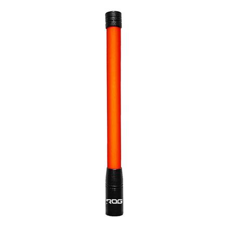
Prepare for your next big adventure in France with this highly detailed mapping product. With fully navigable maps and Garmin ActiveRouting, this new map offers versatile route planning for hiking and cycling, as well as geographic names, points of interest, accommodations, and searchable addresses (over 4,300,000 points of interest).
This mapping is available in the form of a preloaded microSD card from partner dealers. • Includes an enhanced and updated network of hiking trails and paths. • ActiveRouting¹ function, which allows you to customize and plan routes according to the chosen activity: cycling, hiking/walking across the entire network of roads and trails. The displayed map adapts to your activity by recommending routes in addition to different cycling or hiking paths. • Includes geographic names and points of interest. • Includes street names with address and street number search. • Includes a Digital Elevation Model (DEM) with contour interval every 10m (20m in mountainous area). • Provides additional types of accommodation via Gite d'Etape and Refuges
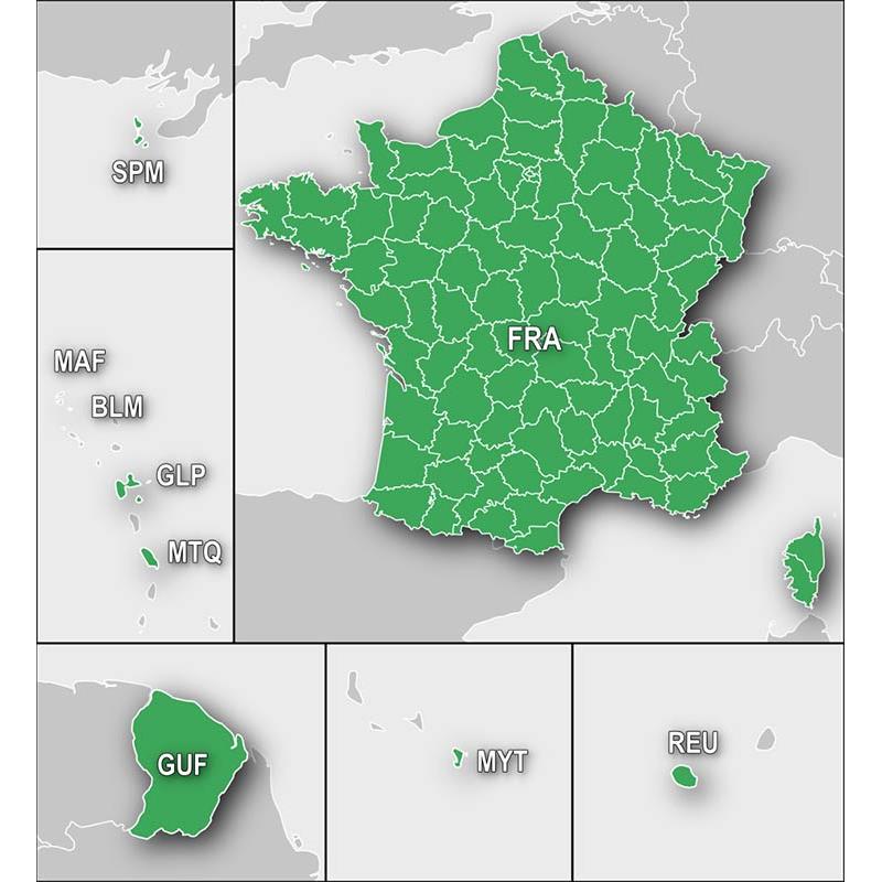
Region: TOPO France v6 PRO, France + DROM COM Coverage: Includes topographic coverage for all of France, including Corsica and Overseas Territories (DROM-COM).
Region: TOPO France v6 PRO, Mountain • Displays detailed information on the trail network (27,000 Km), such as GR, GRP and PR. • The TOPO France v6 PRO Mountain also provides precise raster maps at the reference scale 1:25000 (IGN Scan25® data).
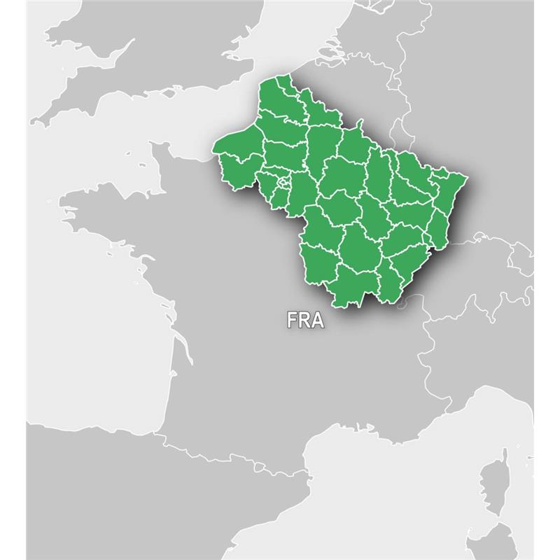
Region: TOPO France v6 PRO, North East • Displays detailed information on the trail network (39,300 Km), such as GR, GRP and PR. • Includes topographic coverage for the departments in the northeast of France: 02, 08, 10, 21, 25, 27, 39, 51, 52, 54, 55, 57, 58, 59, 60, 62, 67, 68, 70, 71, 75, 76, 77, 78, 80, 88, 89, 90, 91, 92, 93, 94 and 95.
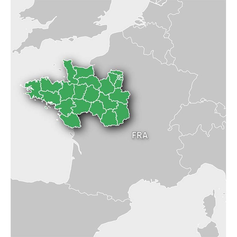
Region: TOPO France v6 PRO, North West • Displays detailed information on the trail network (38,950 Km), such as GR, GRP and PR. • Includes topographic coverage for the departments in the northwest of France: 14, 18, 22, 28, 29, 35, 36, 37, 41, 44, 45, 49, 50, 53, 56, 61, 72, 75, 77, 78, 85, 91, 92, 93, 94 and 95.
Region: TOPO France v6 PRO, North West • Displays detailed information on the trail network (38,950 Km), such as GR, GRP and PR. • Includes topographic coverage for the departments in the northwest of France: 14, 18, 22, 28, 29, 35, 36, 37, 41, 44, 45, 49, 50, 53, 56, 61, 72, 75, 77, 78, 85, 91, 92, 93, 94 and 95.
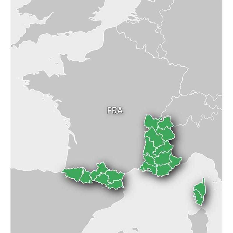
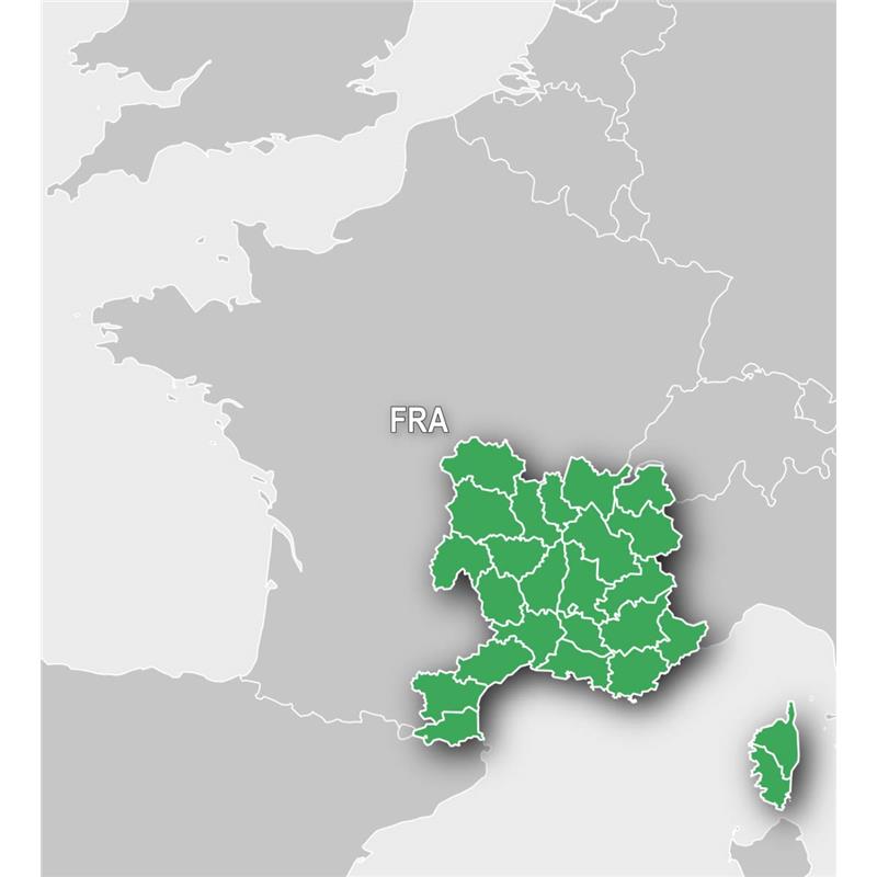
Region: TOPO France v6 PRO, South East • Displays detailed information on the trail network (37,600 Km), such as GR, GRP and PR. • Includes topographic coverage for the departments in the southeast of France: 01, 2A, 2B, 03, 04, 05, 06, 07, 11, 13, 15, 26, 30, 34, 38, 42, 43, 48, 63, 66, 69, 73, 74, 83 and 84.
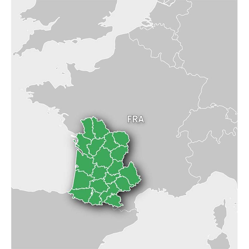
Region: TOPO France v6 PRO, South West • Displays detailed information on the trail network (37,600 Km), such as GR, GRP and PR. • Includes topographic coverage for the departments in the southwest of France: 09, 12, 16, 17, 19, 23, 24, 31, 32, 33, 40, 46, 47, 64, 65, 79, 81, 82, 86 and 87.


 GATOPOV6MONT
 GATOPOV6NE
 GATOPOV6NO

 GATOPOV6FR
 GATOPOV6SE
 GATOPOV6SO