Receive our offers and promo codes by email Subscribe to the newsletter
Models & specificities
Descriptive
Reviews
A question
Besoin de formation
Models & specificitiesDescriptiveReviewsA questionBesoin de formation
Models & specificities
Back to menu
Reference
Price inc VAT
Price inc VAT
010-02812-01 (Unavailable)
€666.50
€666.50
Models & specificitiesDescriptiveReviewsA questionBesoin de formation
Descriptive
Back to menu
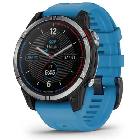
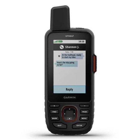
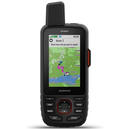
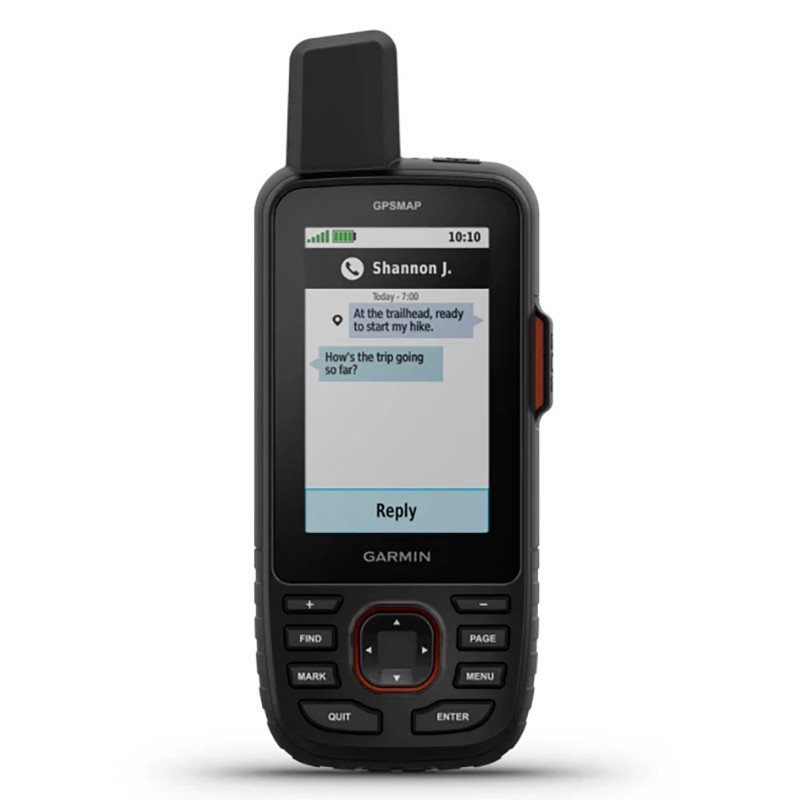
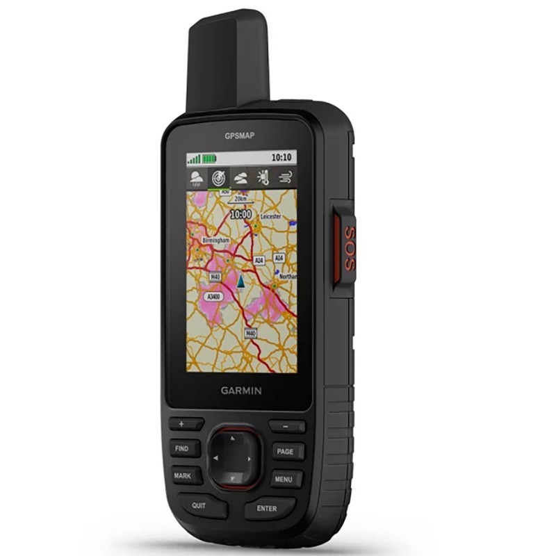
EXPLORE THE GREAT OUTDOORS, WHILE STAYING CONNECTED TO YOUR LOVED ONES Extend the adventure with this robust handheld GPS with satellite communication system. Benefit from inReach® technology that gives you access to two-way messaging, interactive SOS and a position sharing function1, as well as maps to help you navigate.
Continue your adventures with a battery life of up to 165 hours in tracking mode and 425 hours in Expedition mode.
Two-way messaging allows you to share the best moments with your loved ones.
Give your loved ones the opportunity to follow your adventures thanks to position tracking.
Have an emergency? Send an interactive SOS at any time, anywhere in the world.
Track your position in difficult conditions thanks to multi-band technology and extended GNSS support.
MULTI-BAND GNSS SUPPORT
Access to multiple satellite navigation systems (GPS, Galileo and QZSS). Access to multiple frequencies sent by navigation satellites to improve geolocation accuracy in areas where GNSS signals are reflected, weak or generally do not penetrate.
ABC SENSORS Follow every route with the ABC sensors including an altimeter for altitude data, a barometer to monitor the weather and a 3-axis electronic compass for orientation.
SATELLITE IMAGES Download photorealistic high resolution maps directly to your device via the Wi-Fi® network. Easily find trails, choose supply and parking locations, create waypoints and much more.
PRELOADED TOPOACTIVE EUROPE MAPS Preloaded TopoActive Europe maps display summits, parks, coasts, rivers, lakes and geographical landmarks.
PREMIUM MAPPING FEATURES
With an OPTIONAL Outdoor Maps+ subscription, you get information on public lands (USA), parcel maps (USA), property owner names (USA), hunting management area boundaries (USA), Bureau of Land Management (BLM) boundaries and much more2.
BATTERY LIFE Activate Expedition mode to enjoy a battery life of up to 425 hours when using inReach technology. The default tracking mode gives you up to 165 hours of battery life and your device records your position every 10 minutes.
SEND AND RECEIVE MESSAGES Exchange text messages with your loved ones, post messages on social networks or communicate with other inReach devices in the field
INTERACTIVE SOS ALERTS In case of emergency, send an interactive SOS to the Garmin ResponseSM centre, a professional 24/7 emergency response coordination centre.
POSITION SHARING Share a LiveTrack link with your friends and family so they can see your position, follow your progress live and more.
GLOBAL IRIDIUM SATELLITE NETWORK Instead of going through the mobile phone network, your messages, SOS alerts and tracking data are transferred via the global Iridium satellite network.
GARMIN MESSENGER™ APPLICATION Download the Garmin Messenger application on your compatible smartphone, then pair it with your portable GPSMAP® 67i GPS to enjoy fast and easy to use messaging, and send SOS at any time, even outside of cellular coverage areas1. The application also supports group messaging.
GARMIN EXPLORE APPLICATION Plan, view and sync waypoints, routes and tracks using the Garmin Explore mobile app and website. You can even review previous activities while you're still in the field.
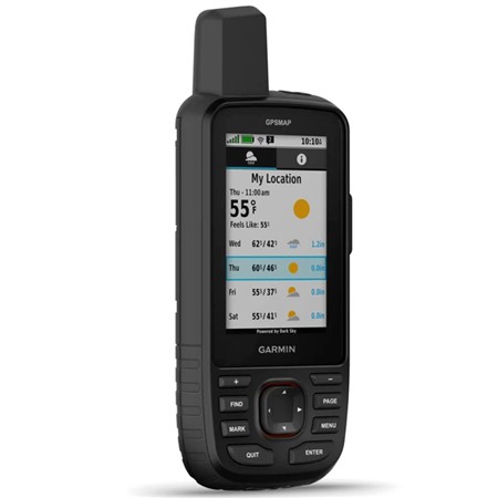
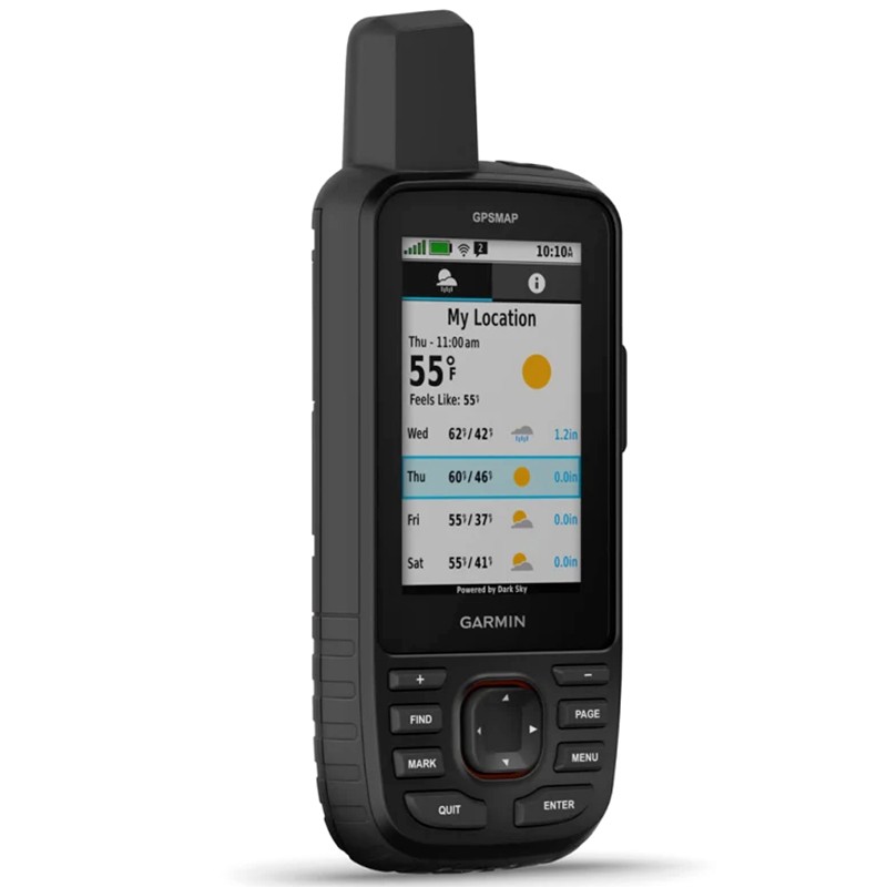
OPTIONAL INREACH WEATHER Use inReach connectivity to get detailed forecast updates on your portable GPSMAP 67i GPS. Request weather forecasts for your location, your waypoints or destinations on your route.
DYNAMIC WEATHER When connected to the Garmin Explore smartphone app, you can get real-time forecasts to avoid being caught off guard by changing weather conditions.
BUILT FOR ADVENTURE This handheld GPS is designed to military standards for heat resistance, shock resistance and water resistance (MIL-STD-810), and it is also compatible with night vision goggles.
LED FLASHLIGHT The GPSMAP 67 series allows you to minimise your equipment thanks to an integrated LED flashlight that can be used as a beacon to signal your position in case of a problem.
TREASURE HUNT Get automatic updates on treasure hunts from Geocaching Live, including descriptions, logs and hints. When the device is connected via Wi-Fi technology or to the Garmin Explore™ smartphone app, all the treasures you find are uploaded to your Geocaching.com profile.
In the box:
GPSMAP 67i USB-A to USB-C cable Carabiner clip Documentation Recycling
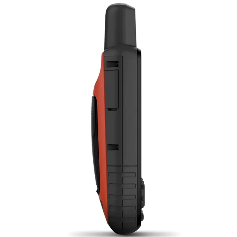
Features: • Glass material: chemically strengthened glass • Physical dimensions: 6.2 x 16.3 x 3.5 cm (2.5″ x 6.4″ x 1.4″) • Weight: 230g with battery • Water Resistance PX7 • MIL-STD-810: Yes (temperature, shock, water) • Display Type: Transflective TFT colour display • Display format (width by height): 3.8 x 6.3 cm (1.5″W x 2.5″H); 7.6 cm diagonal (3″) • Screen resolution (width by height): 240 x 400 pixels • Battery: Internal and rechargeable lithium-ion • Battery Life Up to 165 hours (> 6 days) with inReach® switched on and tracking every 10 minutes Up to 180 hours (> 7 days) in GPS mode Up to 425 hours (> 17 days) in expedition mode with inReach switched on Up to 840 hours in expedition mode • Memory/History: 16GB (user space varies depending on included maps) • Interface: USB-C • Maps and memory • Preloaded maps: Yes (TopoActive Europe; routable on practicable roads and trails) • Ability to add maps: YES • Base map: YES • Automatic route definition (turn-by-turn routing): YES • Map segments 15,000 • BirdsEye: Yes (direct to device) • Includes detailed hydrographic features (coastlines, lake and river shores, swamps and seasonal and permanent waterways): YES • Includes searchable points of interest (parks, campsites, viewpoints and picnic areas): YES • Displays national, federal and local parks, forests, and nature reserves: YES • Storage and Power: Yes (max. microSD™ card 32GB) • Waypoints: 10,000 • Courses: 250, 200 course points per course • Tracks: 250 • Log: 20,000 points, 250 saved GPX tracks, 300 saved fitness activities • Activities: Yes • Routes: 250, 250 points per route; 50 auto routing route points • Rinex Connection: YES
Sensors • GPS: YES • Galileo: YES • QZSS: YES • BeiDou: YES • IRNSS: YES • Barometric altimeter: YES • Compass: Yes (3-axis with tilt compensation) • High sensitivity receiver: YES • GPS Compass (in motion): YES • Multi-band Frequencies: YES • Daily Smart Features • Connect IQ™ (watch faces, data fields, widgets and downloadable apps) • Smart Notifications on portable device • Weather • Dynamic Weather • Compatible with Garmin Messenger app • VIRB® Remote • Compatible with Garmin Connect™ Mobile • Tracking and Safety Features • LiveTrack • Tactical Features • XERO™ Positions • Ballistic Calculator: Yes (unlock required)
inReach® Features • Interactive SOS • inReach Weather • Exchange SMS with mobile numbers and email addresses • Exchange SMS with other inReach devices • Send and receive group messages • Exchange positions with other inReach devices • MapShare compatible with tracking • Virtual keyboard for custom messages • Send waypoints to MapShare during the trip • Send a selection of routes to MapShare during the trip.
Outdoor applications • Compatible with Garmin Explore™ for waypoints, tracks, routes and activities • Compatible with Garmin Explore website • Smart switching between Wi-Fi, cellular and satellite with the Garmin Messenger app
No data is stored by FUGAM/PECHEUR.COM, but it may be stored by the service provider in accordance with its banking obligations.
Payment in installments with Alma
The payment in several times/deferred is available via our partner Alma. The security of the payments is ensured by Alma and its providers. All payments are protected by 3D Secure.
Amount of purchases
P3X : Only purchases between 50 € and 5 000 € are eligible for payment with Alma.
P4X : Only purchases between 50 € and 5 000 € are eligible for payment with Alma.
Fees
By paying in installments with Alma, the Customer does not pay any fees.
Alma is a telepayment manager and issues an electronic certificate that will be considered as proof of the amount and date of the transaction in accordance with the provisions of articles 1316 and following of the civil code.
Cancellation
Any termination of the T&Cs between the Seller and the customer will result in the termination of the UGCs between Alma and the customer.
Payment in installments with Alma
The payment in several times/deferred is available via our partner Alma. The security of the payments is ensured by Alma and its providers. All payments are protected by 3D Secure.
Amount of purchases
P3X : Only purchases between 50 € and 5 000 € are eligible for payment with Alma.
P4X : Only purchases between 50 € and 5 000 € are eligible for payment with Alma.
P10X : Only purchases between 300 € and 5 000 € are eligible for payment with Alma.
Fees
By paying in installments with Alma, the Customer does not pay any fees.
Alma is a telepayment manager and issues an electronic certificate that will be considered as proof of the amount and date of the transaction in accordance with the provisions of articles 1316 and following of the civil code.
Cancellation
Any termination of the T&Cs between the Seller and the customer will result in the termination of the UGCs between Alma and the customer.


 24h
24h