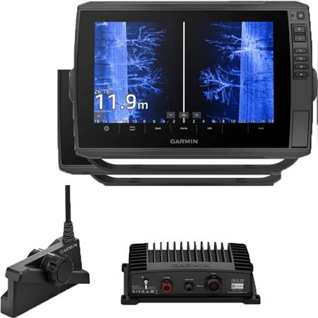
| Function | Value |
|---|
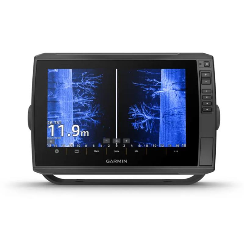
| Screen size | 10 inches |
| Touchscreen | yes |
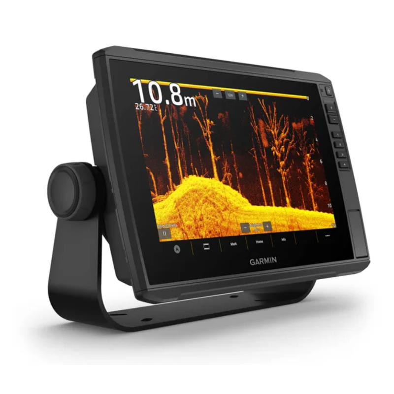
| Classic 2D | yes |
| Down View | yes |
| Side View | yes |
| Chirp | yes |
| GPS | yes |
| Bathymetry | yes |
| Chart reader | yes |
| Live | yes with optional transducer |
| Network | yes |
*subtleties and options may be indicated in the full description, feel free to explore further or ask for advice.
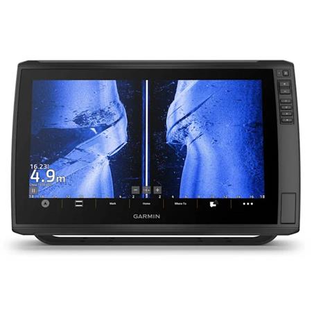
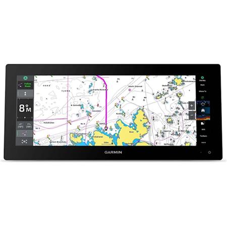
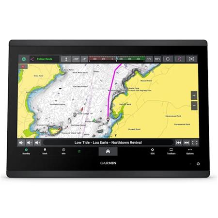
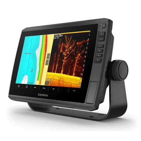
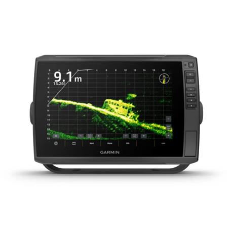
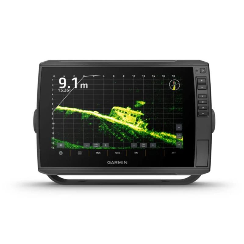
With their large, clear, anti-glare touchscreen, these versatile chartplotters put many fish-detection features at your fingertips. They support Garmin Navionics+™ and Garmin Navionics Vision+™ chart products, and the transducer bundle adds ultra-high-definition scanning sonar and traditional CHIRP sonar features.
• Compatible with our ultra-detailed real-time sonar technologies, including Panoptix LiveScope LVS32, LVS34 and LVS62
• Ability to share sonar data, waypoints and routes with other ECHOMAP Ultra2 10 and 12 inches units, as well as with ECHOMAP UHD2 units
• Built-in Quickdraw Contours for instant creation of custom fishing maps with contour lines every 30 cm
• Built-in Wi-Fi® connectivity for compatibility with the free ActiveCaptain® app
• HELM feature via the free ActiveCaptain® app for data sharing and control of your sonar on your tablet and/or smartphone.
MARINE Charts
Give your chartplotter a whole new look with optional Garmin Navionics+™ or Garmin Navionics Vision+™ premium mapping, featuring content for coastal and inland waters, access to daily updates, Auto Guidance+ technology and much more.
• NMEA 2000® connectivity provides compatibility with electronic compasses, autopilots, digital switching, the FUSION-Link™ audio system and much more
General:
• Physical dimensions: 295 x 195 x 98 mm
• Display size (width by height): 21.7 x 13.6 cm; 10 inches (diagonal)
• Screen resolution (width by height): WXGA; 1280 x 800 px
• Display type: IPS touchscreen (with anti-reflective coating)
• Weight: 1.8 kg
• Water resistance rating: IPX7
• Polarized: Supported
• Power consumption: 26 W
• Antenna: Internal only 10 Hz
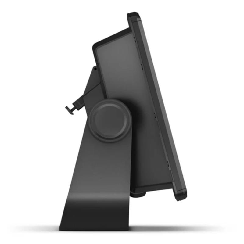
• Mounting options: Tilt/swivel bracket or flush mount
• GPS antenna: 10 Hz
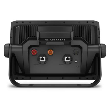
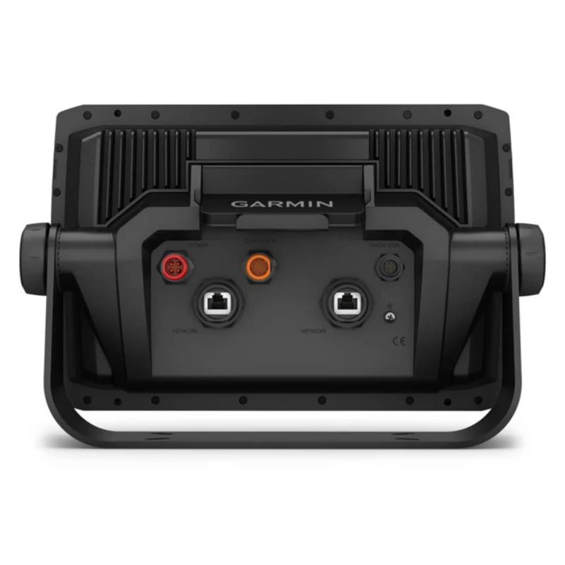
• Garmin Marine Network ports: 2 (large connectors)
Outdoor recreation features:
• Tide table
Chartplotter functions:
• Sonar function: yes
• Supports: AIS (locates positions of nearby vessels)
• Supports: ASN (displays position data from ASN-compatible VHF radios)
• Supports radios compatible with FUSION-Link™
• Supports GCV Black Box sonar
• Compatible with ActiveCaptain: yes
• Sailing features
Sonar functions and features:
• Compatible with dual-frequency sonar
• Compatible with dual-beam sonar
• Transmit power: 600 W (RMS) / 4,000 W (peak-to-peak)
• CHIRP technology compatible: Yes (Built-in)
• ClearVü: yes
• SideVü: yes
• Maximum depth:
- 700 m at 77 kHz, freshwater
- 335 m at 77 kHz, seawater
(Depth estimation depends directly on the type of bottom and other water characteristics)
• Bottom lock (displays the return value from the seabed)
• Water temperature log and graph
• Sonar recording
• Sonar history rewind
Connections:
• Built-in GPS/GLONASS/Galileo 10 Hz
• Wireless connectivity: yes
• CHIRP 40-250 kHz; CHIRP scanning sonar 260/455/800/1200 (ClearVü and SideVü) Single-channel CHIRP: 600W
• Wireless connectivity, NMEA 2000®: 1 port, NMEA 0183: 1x input, 1x output, Garmin Network: 2 ports, Sonar: 1x 12-pin and 1x Panoptix LVS12
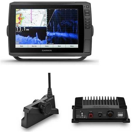
In the box with GT56UHD-TM Transducer:
• ECHOMAP Ultra2 102sv with worldwide basemap
• GT56UHD-TM transducer
• Power/data cable
• Tilt/swivel bracket with quick-release base
• 8-pin transducer to 12-pin sonar adapter cable
• Flush mount
• Protective cover
• Hardware
• Documentation
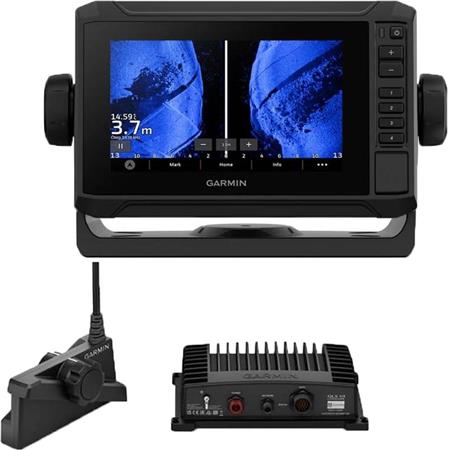
In the box WITHOUT TRANSDUCER:
• ECHOMAP Ultra2 102sv with worldwide basemap
• Power/data cable
• Tilt/swivel bracket with quick-release base
• Flush mount
• Protective cover
• Hardware
• Documentation
Find on Pêcheur.com the best selection among Garmin's offerings to find your next Garmin fishfinder.
User manual


 24h
24h