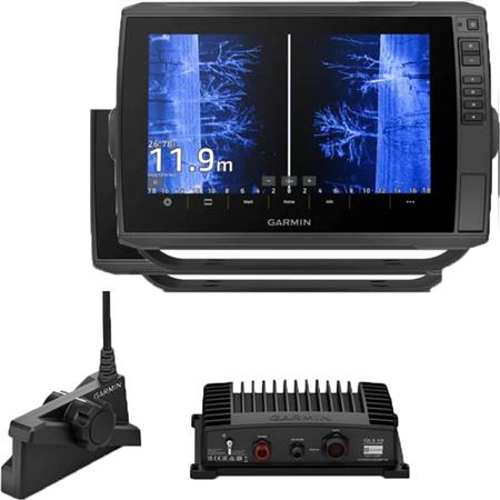
| Function | Value |
|---|
| Screen size | 15 inches |
| Touchscreen | yes |
| Classic 2D | yes |
| Down View | yes |
| Side View | yes |
| Chirp | yes |
| GPS | yes |
| Bathymetry | yes |
| Chart viewer | yes |
| Live | yes with optional transducer |
| Network | yes |
*Subtleties and options may be listed in the full description; feel free to explore further or ask for advice.
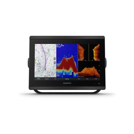
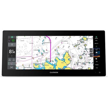
With its almost bezel-less all-glass ultrawide format, this 15-inch plotter with refined design offers you a new perspective at the helm. Its screen is 74% larger and provides more pixels than a standard 9-inch plotter, for improved readability.
15" ULTRAWIDE IPS DISPLAY FOR VARIOUS HELM LAYOUTS, INCLUDING "FLOATING DISPLAY" CONFIGURATIONS
CONNECTIVITY TO THIRD-PARTY DEVICES COMPATIBLE WITH DIGITAL SWITCHING AND ONEHELM™ INTEGRATIONS
EASILY BUILD YOUR MARINE SYSTEM USING OUR ADVANCED NETWORK CONNECTIVITY.
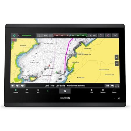
NAVIGATE WITH PEACE OF MIND THANKS TO SUPPORT FOR GARMIN NAVIONICS+™ AND GARMIN NAVIONICS VISION+™ CHARTS
SEE WHAT'S HAPPENING UNDER YOUR BOAT WITH BUILT-IN SONAR CAPABILITIES
MANAGE YOUR BOATING TRIPS WHEREVER YOU ARE, OR ALMOST1
MODERN AND SLEEK DESIGN
With its minimalist bezels and all-glass screen, the GPSMAP 15x3 plotter impresses with its ultrawide, high-resolution touchscreen interface, smooth and intuitive, in the tradition of the GPSMAP x3 series plotters.
CLEAR AND BRIGHT OPTICS
The ultrawide IPS screen of this versatile plotter offers wider viewing angles, accurate colors, exceptional clarity and excellent readability in bright sunlight, even with polarized sunglasses.
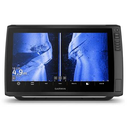
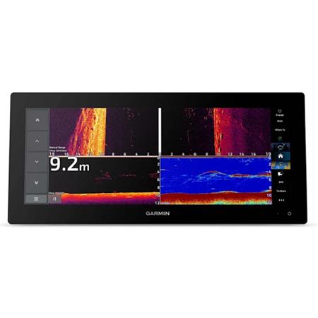
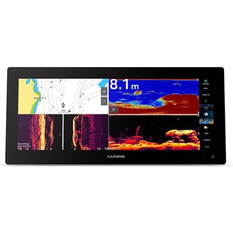
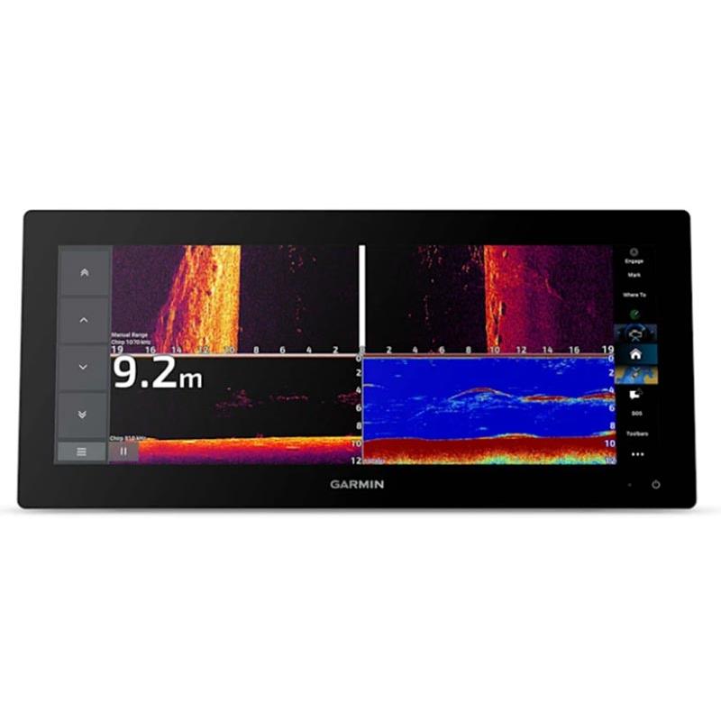
SPLIT DISPLAY
Enjoy a dual screen and smooth controls. The split-screen display lets you size and organize your data as you wish.
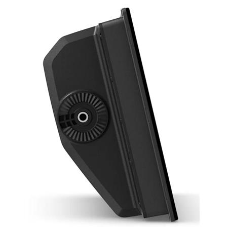
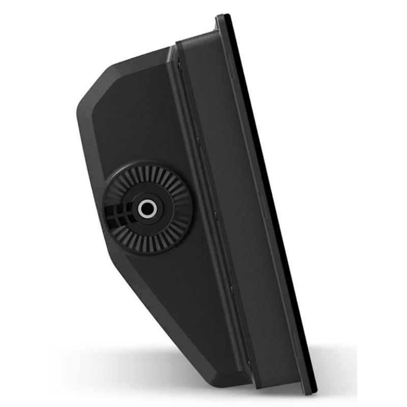
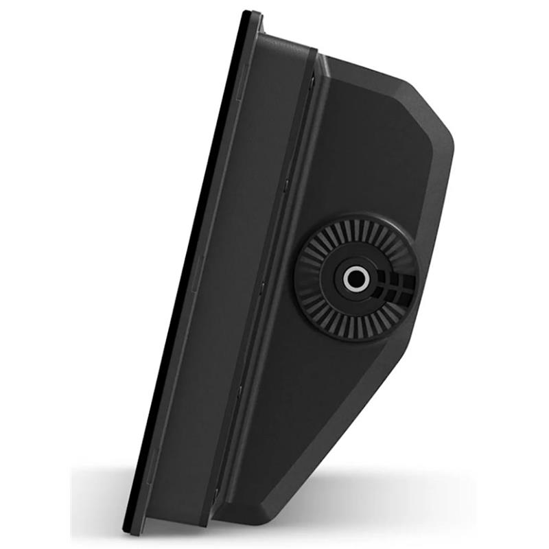
TWO MOUNTING OPTIONS
The optional knurled-screw mounting bracket allows an elegant "floating" installation (sold separately), while a rear installation option is provided for a secure flush or recessed mount in the helm
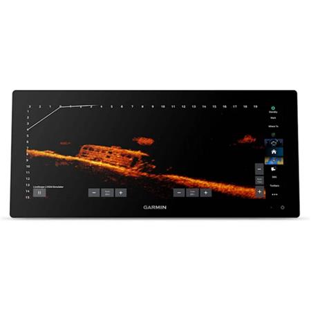
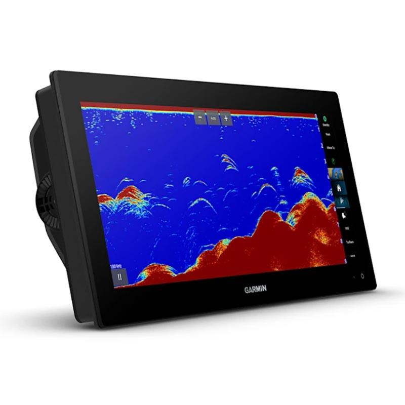
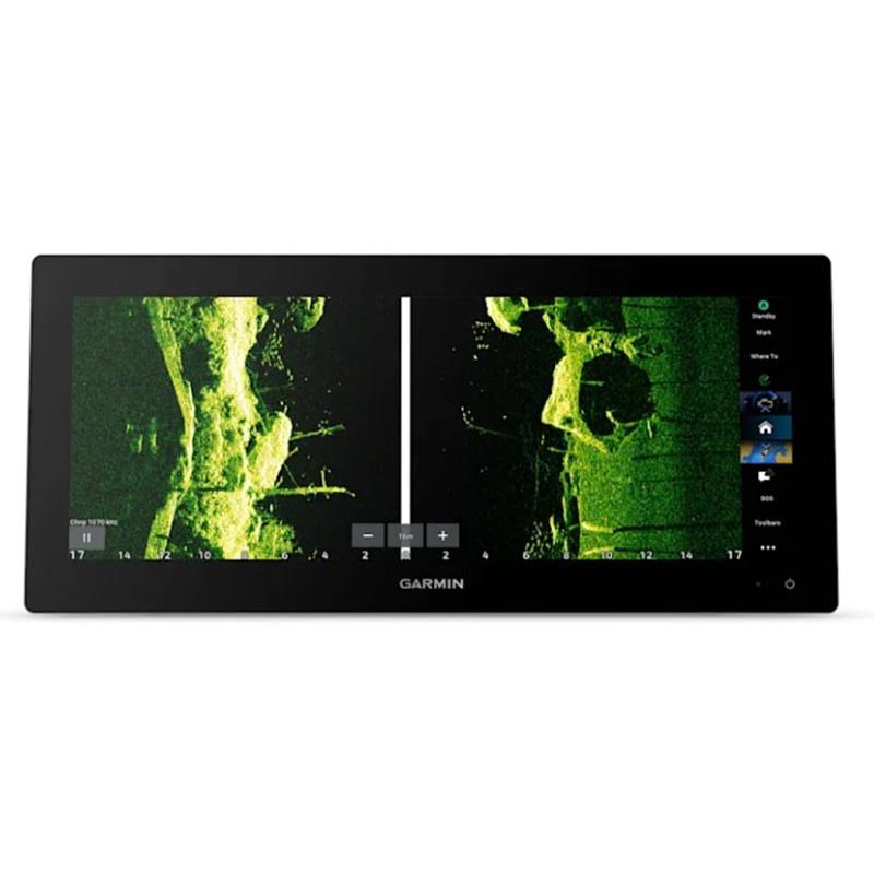
SUPPORT FOR SCANNING AND TRADITIONAL SONAR
Enjoy direct support for a CHIRP 1 kW sonar for finer target separation. Additionally, ultra-high-definition ClearVü™ and SideVü™ scanning sonars provide clear, high-contrast images to better distinguish fish from structure (transducer required, sold separately).
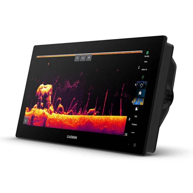
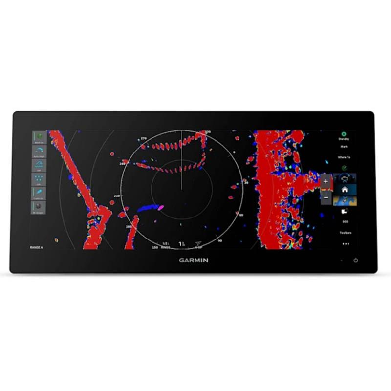
PANOPTIX™ SONAR SUPPORT
Pair your easy-to-interpret Panoptix™ or LiveScope™ real-time sonar (transducer required, sold separately) to see all around your boat in real time.
CHARTS
Navigate with optional Garmin Navionics+™ charts that include Auto Guidance+ technology2, unlimited updates and much more (subscription required).
PREMIUM CHARTS
Enjoy support for Garmin Navionics Vision+™ charts with shaded relief and high-quality satellite imagery.
GARMIN SAILASSIST™ SAILING FEATURES
Display laylines, start line guidance, an optimized wind rose, the true wind line and tracked heading on the background, real wind data fields and a tide/current/duration slider, wind angle, heading and leeway, wind speed, etc.
SAILING POLARS
Consult the polar table for important information, for example the optimal speed at a given wind angle and wind speed. This way you'll know if you need to trim the sails.
GARMIN MARINE NETWORK
If you have multiple compatible Garmin devices on your boat, you can share information between them, including charts, user data, radar images and IP camera video.
NMEA 2000® AND NMEA 0183 NETWORKS
Connect to various systems on a single screen: compatible autopilots, digital switching, weather functions, Fusion® audio systems, VHF, AIS functionality, etc.
ACTIVECAPTAIN® APP
With built-in Wi-Fi®, pair the all-in-one free mobile app to access OneChart™, Smart Notifications (when the device is paired with your smartphone), software updates, the Helm™ app, Garmin QuickDraw™ community data and much more1.
BUILT-IN ANT® TECHNOLOGY
Connect to some of your favorite devices, such as quatix® marine watches, gWind™ Wireless 2 sensors, GNX™ Wind marine instruments and wireless remote controls.
ENGINE CONNECTIVITY
You can connect your plotter to various engines, including certain Yamaha® and Mercury® engines.
ONEHELM FEATURE
This feature brings together all EmpirBus™ digital switching functions and other third-party devices on a single screen.
SEND MESSAGES FROM AN INREACH® DEVICE
Pair your inReach3 satellite communication system to your plotter and compose custom messages using your multifunction display's virtual keyboard. Access your contacts list or enter an email address, an inReach address or a phone number. You can also group your messages by conversation, just like SMS exchanges.
POWER-POLE® ANCHORS FOR SHALLOW WATER
By networking the GPSMAP 15x3 plotter with your Force® electric motor and compatible Power-Pole shallow-water anchor system, you can access advanced boat control features4 from your plotter, including automatic intelligent anchor deployment, intelligent anchor pivoting, automatic stow, drift detection and end-of-track anchoring. Spend more time fishing and less time positioning your boat.
ELECTRIC MOTOR INTEGRATION
Enjoy compatibility and integration with your Force series electric motor (sold separately) for better control while fishing.
INSTALLATION INSTRUCTIONS
USER MANUAL
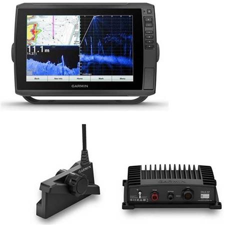
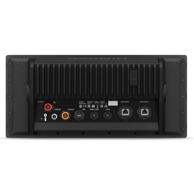
In the box:
• GPSMAP 1523xsv ultrawide plotter without transducer
• Power cable
• Low-profile flush mount kit with gasket
• Protective cover
• 8-pin transducer to 12-pin sonar adapter cable
• 2-meter backbone/drop cable and T-connector for the NMEA 2000® network
• Documentation


 24h
24h